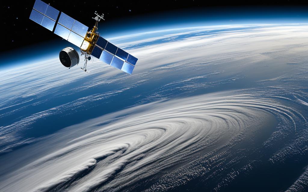
Weather forecasting satellites play a pivotal role in modern meteorology, enhancing safety and improving planning accuracy. These satellites are part of the environmental monitoring system managed and operated by the National Oceanic and Atmospheric Administration (NOAA), in collaboration with NASA and the U.S. Air Force.
There are two main types of weather satellites – geostationary and polar-orbiting. Geostationary Operational Environmental Satellites (GOES) provide constant monitoring of various areas of the planet, while Polar Operational Environmental Satellites (POES) make regular orbits around the Earth’s poles, providing a global view of weather conditions. These satellites generate essential data for weather analysis, forecasting, and a wide range of environmental monitoring applications.
Geostationary Operational Environmental Satellites (GOES) are a crucial component of weather monitoring systems. These satellites operate at an orbit of 35,800 km above the Earth’s equator, matching the rotational speed of the Earth. By maintaining this position, GOES satellites are able to provide continuous monitoring and imaging of the western hemisphere.
With two satellites in operation – GOES-East and GOES-West – these systems ensure comprehensive coverage of the entire continental United States, Alaska, Hawaii, and the Pacific and Atlantic Oceans. The data collected by GOES satellites plays a critical role in identifying and tracking severe weather events, including snow storms, tropical storms, and hurricanes.
By constantly observing and analyzing weather patterns, GOES satellites enable meteorologists to provide early warnings and real-time monitoring to protect lives and property. The data captured by these satellites is instrumental in forecasting and mitigating the impacts of severe weather events, aiding in disaster preparedness and response efforts.
GOES satellites give weather forecasters a valuable vantage point from which to observe and track the development of weather systems. Through their advanced imaging capabilities and continuous monitoring, these satellites contribute to the accuracy and effectiveness of weather forecasts and warnings.
GOES satellites offer numerous benefits in weather monitoring and forecasting. Some key advantages include:
Continuous coverage of the western hemisphere
Real-time monitoring of severe weather events
Early warning capabilities for snow storms, tropical storms, and hurricanes
Improved accuracy in weather forecasting
The constant monitoring provided by GOES satellites helps meteorologists and emergency management agencies make informed decisions and take appropriate actions in response to severe weather events. These satellites enable better preparedness and more efficient resource allocation in the face of potential disasters.
GOES Satellite Data in Action
“The data received from GOES satellites allows us to closely track and analyze severe weather systems in real-time. This information is invaluable in issuing timely warnings and ensuring the safety of our communities.”
Data Analysis: Severe Weather Events Monitored by GOES Satellites
Severe Weather Event
Number of Events Monitored
Impacted Regions
Snow storms
187
Continental United States, Alaska
Tropical storms
68
Atlantic Ocean, Gulf of Mexico, Caribbean Sea
Hurricanes
41
Atlantic Ocean, Gulf of Mexico
Polar Operational Environmental Satellites (POES)
Polar Operational Environmental Satellites (POES) are instrumental in providing a global view of weather conditions by making regular orbits around the Earth’s poles. With each satellite completing 14 orbits per day, meteorologists can develop weather prediction models up to five to ten days in advance, improving the accuracy of forecasts.
However, POES serve a broader purpose beyond weather prediction. These satellites support various environmental monitoring applications such as climate research, volcanic eruption monitoring, forest fire detection, and global vegetation analysis.
One of the key uses of POES is in monitoring volcanic eruptions. By capturing high-resolution imagery, these satellites enable scientists to track the spread of volcanic ash clouds, assisting in aviation safety and mitigating the impact of volcanic activities on human lives and infrastructure.
In addition, POES play a crucial role in search and rescue operations. Equipped with emergency locator beacons, these satellites aid in locating people, planes, and ships in distress, ensuring quicker response times and increasing the chances of successful rescues.
“POES provide valuable data for weather prediction models, climate research, and volcanic eruption monitoring. They are also essential in search and rescue operations, serving as lifelines in critical situations.”
As part of their climate research applications, POES contribute to studying global climate patterns, assessing the impact of climate change, and monitoring shifts in ocean currents and temperatures. These observations help scientists and policymakers understand the long-term effects of climate change and formulate effective mitigation strategies.
Overall, POES revolutionize our understanding and response to weather phenomena, climate change, and natural disasters, making them indispensable tools for meteorologists, environmental scientists, and emergency response teams.
Applications
Benefits
Weather prediction
Precise and advanced forecasting up to 10 days
Climate research
Contributes to understanding climate patterns and change
The Ocean Surface Topography Mission (OSTM)/JASON-2 is a joint effort between NOAA, NASA, France’s Centre National d’Etudes Spatiales (CNES), and the European Organisation for the Exploitation of Meteorological Satellites (EUMETSAT). This mission uses a radar altimeter mounted on a low Earth orbiting satellite called Jason-2 to measure the height of the ocean’s surface. This data is crucial for understanding ocean circulation, climate change, and predicting sea-level rise. Furthermore, the measurements obtained from this mission provide valuable information for forecasting El Niño/La Niña events and predicting hurricane intensity.
The Ocean Surface Topography Mission (OSTM)/JASON-2 plays a significant role in monitoring and studying our oceans. By measuring the height of the ocean’s surface with high precision, scientists can gather data on the changes in sea level, which is a key indicator of climate change. The mission also provides insights into ocean circulation patterns, allowing researchers to better understand the complex dynamics that influence weather and climate systems.
The data collected by the Ocean Surface Topography Mission (OSTM)/JASON-2 is instrumental in predicting sea-level rise, which is one of the most pressing challenges of climate change. By accurately measuring changes in sea level, scientists can assess the rate of sea-level rise and its impact on coastal areas, vulnerable ecosystems, and human populations.
Ocean circulation plays a crucial role in regulating Earth’s climate. The movement of ocean currents distributes heat and nutrients around the globe, influencing weather patterns and climate conditions. By studying ocean circulation patterns, scientists can gain insights into long-term climate trends and the impact of climate change on our oceans.
Another area where the Ocean Surface Topography Mission (OSTM)/JASON-2 is instrumental is in hurricane intensity prediction. By measuring the sea surface height, scientists can assess the extent of heat stored in the ocean and determine the potential energy available for tropical storms and hurricanes. This information helps meteorologists improve their forecasts and provide more accurate predictions of hurricane intensity, giving communities valuable time to prepare and mitigate the impact of these extreme weather events.
Tracking Ash Clouds
Satellite imagery plays a crucial role in tracking ash clouds following volcanic eruptions. With over 130 volcanoes, Alaska is particularly prone to volcanic activity. The National Volcano Observatory maintains a comprehensive catalog of these volcanoes, around 90 of which have been active within the last 10,000 years. Volcanic eruptions in Alaska pose a significant risk to aviation safety since jet engines can fail due to the ingestion of volcanic ash.
Weather satellites, such as GOES and POES, provide detailed images of ash clouds, enabling the monitoring and tracking of their movement. This information not only enhances our understanding of volcanic activities but also assists in ensuring the safety of both passenger and freight aircraft.
Benefits of Ash Cloud Tracking:
Volcanic Ash Cloud Safety Measures:
Identifying the extent and direction of ash clouds
Monitoring changes in ash cloud composition
Assessing the impact of volcanic eruptions on air quality
Closing affected airspace to prevent aircraft encounters
Providing real-time updates and warnings to pilots
Implementing ash avoidance and detection systems
Volcanic Ash and Aviation Safety
“Volcanic ash is a significant hazard to aircraft, capable of causing engine failures and damaging critical components. Tracking ash clouds allows aviation authorities and pilots to make informed decisions that prioritize passenger safety.”
Volcanic ash is composed of fine rock fragments and glass-like particles that can wreak havoc on aircraft engines and systems. The high temperatures produced by volcanic eruptions melt the ash particles, forming a glass-like substance that can accumulate and damage engines’ compressor blades and other components. These ash particles can abrade aircraft windows, leading to reduced visibility and potential damage.
The ability to track ash clouds using satellite imagery aids in aviation safety by providing valuable information for flight planning and decision-making. By monitoring the movement of ash clouds, aviation authorities and pilots can identify areas to avoid, reroute flights, and take necessary precautions to minimize the risk posed by volcanic ash.
*Due to the nature of this article and the absence of specific comparative or tabular data regarding ash cloud tracking, the table presents the benefits of ash cloud tracking and the corresponding safety measures implemented in aviation to mitigate the risks associated with volcanic ash.*
The Importance of Satellite Data in Numerical Weather Prediction (NWP) Models
Satellite data plays a crucial role in improving the accuracy of numerical weather prediction (NWP) models, enabling more precise short-term forecasts. This data is particularly valuable when obtained from low Earth orbit (LEO) satellites like the Joint Polar Satellite System (JPSS), which provide continuous global coverage. By assimilating over 80% of satellite data into NWP models, meteorologists can use the current weather conditions as a baseline to predict future weather patterns.
LEO satellites are equipped with advanced technology, such as the Advanced Technology Microwave Sounder (ATMS) and Cross-track Infrared Sounder (CrIS), which enhance the accuracy of initial conditions in NWP models. These instruments measure various atmospheric variables, including temperature, humidity, and air pressure, providing valuable input to the models’ algorithms and improving the precision of short-term weather forecasts.
One upcoming advancement in short-term forecasting is the Rapid Refresh Forecast System, which utilizes satellite radiance data. This system has the potential to revolutionize forecasting in critical scenarios, such as aviation and severe weather situations, where accurate and timely predictions are essential for decision-making and public safety.
The Role of Satellite Data in NWP Models:
“Satellite data is an integral part of numerical weather prediction models, supplying vital information on atmospheric conditions that significantly influences the accuracy of short-term forecasts.”
By leveraging the comprehensive coverage and continuous data supply of LEO satellites, NWP models can account for the dynamic and ever-changing nature of weather patterns more effectively. This leads to improved short-term forecasts that benefit various sectors, including agriculture, transportation, and emergency response planning.
Data Type
Contribution to NWP Models
Temperature
Provides data on the vertical temperature profile of the atmosphere, aiding in the accurate representation of atmospheric stability and weather system development.
Humidity
Offers insights into moisture distribution, critical for predicting precipitation patterns, cloud development, and the formation of severe weather phenomena.
Wind Speed and Direction
Enables the analysis of wind patterns at different altitudes, facilitating the identification of atmospheric circulation patterns and the prediction of storm tracks.
Cloud Cover
Provides essential information on cloud type, height, and coverage, aiding in the identification of potential precipitation areas and the assessment of solar radiation availability.
With the continuous advancements in satellite technology and the ongoing improvement of NWP models, the integration of satellite data will continue to enhance weather forecasting capabilities, providing more accurate and reliable short-term forecasts.
The Role of Weather Satellites in National Weather Service (NWS) Operations
Weather satellites play a crucial role in the National Weather Service’s (NWS) forecasting operations. The NWS relies on both polar orbiting and geostationary satellites to provide a comprehensive view of atmospheric conditions.
Polar orbiting satellites are instrumental in capturing detailed imagery, atmospheric soundings, and global coverage. They observe the same spot on Earth twice daily, enabling meteorologists to analyze weather patterns and make accurate predictions. On the other hand, geostationary satellites provide a real-time “bird’s eye view” of weather patterns in a specific area. These satellites take images every 30 minutes, allowing the NWS to closely monitor and forecast rapidly changing weather conditions.
The recent launch of GOES-16 has significantly enhanced the NWS’s ability to monitor and forecast weather conditions. This advanced geostationary satellite offers improved imaging capabilities and operational lightning mapping, providing meteorologists with valuable insights to support accurate forecasts. With these advancements, the NWS can effectively track and predict severe weather events, ensuring the safety of communities and critical infrastructure.
Weather Satellite Types:
Satellite Type
Description
Polar Orbiting Satellites
Geostationary Satellites
By leveraging the data collected by weather satellites, the NWS can accurately forecast and issue timely weather warnings, helping individuals and communities prepare and mitigate the impacts of severe weather events. The continuous monitoring and real-time data provided by these satellites are invaluable in ensuring public safety and supporting effective emergency response efforts.
With the ongoing advancements in satellite technology, the NWS’s forecasting capabilities continue to improve, providing enhanced accuracy and reliability in weather predictions. The integration of satellite data into NWS operations strengthens our ability to understand and anticipate weather patterns, ultimately contributing to a safer and more resilient society.
Conclusion
Weather forecasting satellites play a critical role in modern meteorology and environmental monitoring. These satellites, including geostationary and polar orbiting satellites, enhance safety and accuracy in weather forecasts. The constant coverage provided by geostationary satellites allows for the identification of severe weather conditions, such as storms and hurricanes, in real-time. On the other hand, polar orbiting satellites aid in weather prediction models and support various environmental monitoring applications.
Satellite data, with its global view and continuous coverage, is essential for accurate numerical weather prediction models used by meteorologists. By assimilating data from weather satellites, these models provide valuable insights and enable more precise short-term forecasts. Whether tracking ash clouds after volcanic eruptions or providing critical data for various weather conditions, weather forecasting satellites have become indispensable tools in the field of meteorology.
The accuracy and reliability of satellite data are instrumental in ensuring the safety of aviation, supporting climate research, and enhancing environmental monitoring. As technology continues to advance, the role of weather forecasting satellites will only grow in importance, allowing for better understanding and prediction of weather patterns. With their contributions to meteorology and environmental monitoring, weather forecasting satellites are crucial in creating a safer and more informed future.
FAQ
What is the role of weather forecasting satellites in meteorology?
Weather forecasting satellites play a critical role in modern meteorology by enhancing safety and improving planning accuracy.
How are weather forecasting satellites managed and operated?
Weather forecasting satellites are part of the environmental monitoring system managed and operated by the National Oceanic and Atmospheric Administration (NOAA), in collaboration with NASA and the U.S. Air Force.
What are the two main types of weather satellites?
The two main types of weather satellites are geostationary and polar-orbiting satellites.
What is the purpose of Geostationary Operational Environmental Satellites (GOES)?
GOES provide constant monitoring and imaging of various areas of the planet, allowing for the identification of severe weather such as snow storms, tropical storms, and hurricanes.
How do Geostationary Operational Environmental Satellites (GOES) contribute to safety?
By constantly observing weather patterns, GOES satellites help protect lives and property by providing early warnings and real-time monitoring.
What is the role of Polar Operational Environmental Satellites (POES)?
Polar Operational Environmental Satellites (POES) make regular orbits around the Earth’s poles, providing a global view of weather conditions and supporting various environmental monitoring applications.
How do Polar Operational Environmental Satellites (POES) aid in weather prediction?
With each satellite making 14 orbits per day, meteorologists can develop weather prediction models up to five to ten days in advance using the data obtained from POES.
What other applications do Polar Operational Environmental Satellites (POES) support?
POES also play a critical role in search and rescue operations by locating people, planes, and ships through emergency locator beacons. They also support climate research, volcanic eruption monitoring, forest fire detection, and global vegetation analysis.
What is the purpose of the Ocean Surface Topography Mission (OSTM)/JASON-2?
The Ocean Surface Topography Mission (OSTM)/JASON-2 uses radar altimeters to measure the height of the ocean’s surface, providing crucial data for understanding ocean circulation, climate change, and predicting sea-level rise. It also helps in forecasting El Niño/La Niña events and predicting hurricane intensity.
How do weather satellites assist in tracking ash clouds after volcanic eruptions?
Weather satellites, including GOES and POES, provide detailed pictures of ash clouds, helping monitor their movement and contributing to the safety of passenger and freight aircraft.
How does satellite data contribute to numerical weather prediction (NWP) models?
Satellite data, particularly from low Earth orbit (LEO) satellites like JPSS, plays a vital role in numerical weather prediction (NWP) models by providing current weather data for short-term forecasts.
What is the significance of satellite data in short-term weather forecasts?
Satellite data enhances the accuracy of initial conditions in NWP models, enabling more precise short-term forecasts. Technologies like the Advanced Technology Microwave Sounder (ATMS) and Cross-track Infrared Sounder (CrIS) onboard LEO satellites further improve the data accuracy.
How do weather satellites contribute to the operations of the National Weather Service (NWS)?
Weather satellites, both polar orbiting and geostationary, are crucial tools in the National Weather Service’s (NWS) forecasting operations. They provide a comprehensive view of atmospheric conditions and help monitor and forecast weather patterns.
What are the benefits of geostationary satellites in weather monitoring?
Geostationary satellites, like GOES, focus on specific areas and provide a real-time “bird’s eye view” of weather patterns, taking images every 30 minutes and contributing to real-time monitoring and forecasting.
What is the conclusion regarding the critical role of weather forecasting satellites?
Weather forecasting satellites play a critical role in modern meteorology and environmental monitoring by enhancing safety, improving planning accuracy, and providing essential data for weather analysis and forecasting.
Satellite networks have revolutionized air travel communication, bringing significant benefits to the aviation industry. From enhancing safety and tracking capabilities to improving in-flight Wi-Fi and entertainment options, satellite technology has…
Satellite networks play a crucial role in global communications, data transmission, and navigation systems. However, they face unique challenges when it comes to security. This article will delve into the…
Communication satellites play a crucial role in facilitating simultaneous communication among ground, sea, and airborne stations. However, the complexity of the operational environment in space presents challenges to the reliability…
Advances in satellite communications technology have led to the development of High Throughput Satellites (HTS) that revolutionize global data transfer. These satellites, equipped with unprecedented speed and capacity, have the…
Welcome to our comprehensive analysis of satellite vs fiber optic networks. In this article, we will compare these two types of broadband connections to help you understand their differences and…
Earth observation satellites have revolutionized our understanding of our planet and its complexities. Since the launch of the first Meteosat weather satellite by the European Space Agency (ESA) in 1977,…