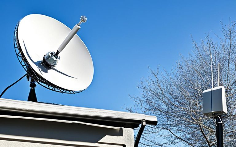
Satellite networks generate vast amounts of data, which directly impacts the value and success of missions. To effectively handle this data, efficient data compression techniques are essential. In this article, we will explore the various methods and technologies that enable satellite data compression, ensuring reliable communication and maximizing mission value.
The Consultative Committee for Space Data Systems (CCSDS) plays a crucial role in setting standards for data compression in space missions, including those for image compression and housekeeping data compression. These standards provide guidelines and algorithms that assist in achieving efficient data compression.
Implementing efficient data compression techniques in satellite networks offers several benefits. Firstly, it allows for the transmission and storage of large amounts of data in a more manageable format. This is particularly important in remote and challenging environments where bandwidth and storage resources may be limited.
Furthermore, efficient data compression techniques contribute to robust connectivity, particularly in unstable connections. The new CCSDS standard for the compression of fixed-length housekeeping data, based on the POCKET+ algorithm, offers parameters that adapt to changes in the data and maintain context in unstable connections. This ensures reliable communication and minimizes the risk of data loss.
Implementations of the CCSDS standards are currently under review and being tested with data from notable missions such as ESAs Rosetta and Venus Express. This ongoing research and development reflect the importance of efficient data compression in satellite networks and the continuous efforts to improve compression techniques.
In the upcoming sections, we will delve into various efficient data compression techniques, including lossless and near-lossless compression for satellite images, dictionary-based sparse representation methods for satellite data compression, and disentangled representation learning for satellite image series compression. These methods showcase the advancements and capabilities of data compression in satellite networks.
Stay tuned to explore how these techniques enable the efficient transmission and storage of satellite data, revolutionizing applications such as smart cities, disaster management, and beyond.
Lossless and Near-Lossless Compression Techniques for Satellite Images
When it comes to compressing satellite images, two techniques stand out: lossless compression and near-lossless compression. These methods allow for the efficient storage and transmission of satellite imagery while preserving valuable information. Let’s explore each technique in more detail.
Lossless Compression
Lossless compression techniques are designed to compress satellite images without losing any information. This means that the reconstructed image is exactly the same as the original image. By eliminating redundancies and encoding the data more efficiently, lossless compression achieves a significant reduction in file size without sacrificing any visual quality.
An important advantage of lossless compression is that it guarantees data integrity, making it ideal for applications where every bit of information is crucial. Whether it’s for scientific analysis or accurate visualization, lossless compression ensures that satellite images retain their original fidelity.
Near-Lossless Compression
Near-lossless compression, on the other hand, offers a different approach. While it allows for some loss of information, it aims to maintain a high level of quality in the compressed image. This technique achieves a higher compression ratio compared to lossless compression, enabling more efficient storage and transmission of satellite images.
Near-lossless compression strikes a balance between compression ratio and image quality. It still preserves significant details and maintains the overall visual integrity of the image, making it suitable for various applications where a minor loss of information is acceptable.
The compression ratio achieved with lossless compression techniques for optical satellite images is normally less than 3:1, depending on the redundancy in the images. Near-lossless compression techniques can further enhance the compression ratio while ensuring the quality remains at an acceptable level.
Lossless and near-lossless compression techniques are essential for optimizing satellite image storage and transmission. These techniques enable the efficient utilization of limited bandwidth and storage resources while maintaining the integrity and quality of satellite images.
To illustrate the difference between lossless and near-lossless compression, let’s consider an example:
| Image | Original Size | Lossless Compression | Near-Lossless Compression |
|---|---|---|---|
| 10 MB | 3 MB | 1.5 MB |
In the example above, the original satellite image has a size of 10 MB. Through lossless compression, the image size is reduced to 3 MB while maintaining the exact image data. With near-lossless compression, the image size is further reduced to 1.5 MB by allowing a minimal loss of information.
By implementing lossless and near-lossless compression techniques, satellite networks can effectively manage the large volume of data generated by satellite missions. These techniques contribute to more efficient data storage, faster transmission, and improved utilization of network resources.
Dictionary-based Sparse Representation Methods for Satellite Data Compression
Dictionary-based sparse representation methods offer an effective approach for satellite data compression. By utilizing machine learning techniques, these methods train a dictionary that can represent satellite data sparsely, leading to efficient compression.
Satellite data, especially remote sensing data, can be effectively represented using a small set of atoms from the dictionary. This sparse representation enables the reduction of data size without significant loss of information.
The construction and optimization of the dictionary model are achieved through optimization algorithms such as K-SVD and low-rank matrix recovery theory. These algorithms ensure that the dictionary accurately captures the essential features of the satellite data.
Through dictionary-based sparse representation, satellite images and videos can achieve a high compression ratio, reducing the storage and transmission requirements. This compression technique preserves important details while efficiently managing the large volumes of data generated by satellite missions.
Incorporating Machine Learning Techniques
Machine learning plays a crucial role in dictionary-based sparse representation methods. By training the dictionary using a large dataset of satellite data, the model can learn the underlying patterns and structures within the data.
“Dictionary-based sparse representation allows for the efficient compression of satellite data by representing it using a reduced set of atoms.”
By incorporating machine learning techniques, the dictionary can adapt to the unique characteristics of satellite data, enhancing the compression efficiency further. The dictionary-based sparse representation approach has shown significant promise in achieving high compression ratios for both satellite images and videos.
Benefits of Dictionary-based Sparse Representation
Dictionary-based sparse representation methods offer several advantages for satellite data compression:
- High compression ratios: By representing data sparsely, these methods can achieve substantial reductions in file size without significant loss of quality.
- Preservation of important features: The compression process retains the essential features of satellite data, ensuring important details are preserved.
- Efficient storage and transmission: The reduced file size enables more efficient storage and transmission of satellite data, optimizing resources and facilitating faster data transfer.
This table illustrates the compression performance of dictionary-based sparse representation methods compared to other compression techniques:
| Compression Technique | Compression Ratio |
|---|---|
| Dictionary-based Sparse Representation | High |
| Lossless Compression | Moderate |
| Other Compression Techniques | Low |
Table: Compression performance comparison of dictionary-based sparse representation methods with other techniques.
The image above highlights the concept of dictionary-based sparse representation, where a reduced set of atoms is used to represent satellite data efficiently.
Disentangled Representation Learning for Satellite Image Series Compression
Disentangled representation learning is a powerful method used to effectively compress satellite image series. This technique focuses on modeling the complex evolution of landscape appearance in a series of satellite images. By separating the stable structure from the changing environment, a representation model can be created that captures the consistent landscape and variational shooting conditions.
This representation model plays a crucial role in improving the compression performance of satellite image series. It enables the generation of a more precise reference frame for target frames, resulting in significant bitrate savings compared to state-of-the-art compression schemes. Using disentangled representation learning, researchers and practitioners can achieve more efficient transmission and storage of large amounts of satellite data.
Experimental Results
Experimental results have shown that the application of disentangled representation learning in satellite image series compression leads to remarkable improvements in compression efficiency. With this approach, the bitrate savings achieved are substantial, allowing for better utilization of network resources and more cost-effective storage solutions.
Comparison to Traditional Compression Techniques
Disentangled representation learning outperforms traditional compression techniques in terms of compression performance. By capturing the consistent aspects of the landscape and incorporating variational shooting conditions, this approach achieves higher compression ratios without compromising the quality of the reconstructed image.
Application in Satellite Data Analysis
The disentangled representation model obtained through this learning process can also be applied in satellite data analysis. By identifying and separating the stable structure from the changing environment, it becomes possible to extract valuable insights and trends from the image series. This has implications for a wide range of applications, including land cover analysis, environmental monitoring, and disaster management.
| Advantages of Disentangled Representation Learning for Satellite Image Series Compression | Challenges |
|---|---|
| Significant bitrate savings | Ensuring the accuracy of the reconstructed image |
| Improved compression efficiency | Computational complexity of the learning process |
| Preservation of image quality | Optimizing the disentangled representation model for different satellite image series |
Conclusion
In conclusion, efficient data compression techniques are essential for maximizing mission value and ensuring robust connectivity in satellite networks. Organizations like CCSDS provide comprehensive guidelines and algorithms for compressing satellite data, including housekeeping data. Lossless and near-lossless compression techniques are commonly employed for compressing satellite images, while promising approaches such as dictionary-based sparse representation methods and disentangled representation learning are being explored for satellite data compression.
By implementing these efficient compression techniques, satellite networks can facilitate the efficient transmission and storage of vast amounts of satellite data. This opens up a wide range of possibilities for applications in smart cities, disaster management, and other industries that heavily rely on accurate and timely satellite data.
Efficient data compression not only reduces the bandwidth required for data transmission but also enables optimal usage of storage capacity. Moreover, these techniques help ensure that critical satellite data is retained and transmitted securely, even in unstable or limited connectivity scenarios. Thus, efficient data compression plays a pivotal role in enhancing the overall performance and reliability of satellite networks.
FAQ
How does satellite data compression benefit satellite networks?
Satellite data compression techniques maximize mission value and ensure robust connectivity by efficiently transmitting and storing large amounts of satellite data.
What are lossless and near-lossless compression techniques for satellite images?
Lossless compression techniques for satellite images retain all information from the original image, while near-lossless techniques allow for some loss of information while maintaining a high level of quality.
How efficient is lossless compression for optical satellite images?
Lossless compression techniques achieve a compression ratio of less than 3:1 for optical satellite images, depending on the redundancy in the images.
What are dictionary-based sparse representation methods for satellite data compression?
Dictionary-based sparse representation methods use machine learning techniques to train a dictionary that efficiently represents satellite data using a small set of atoms.
Are there any specific optimization algorithms used in dictionary-based sparse representation methods?
Yes, optimization algorithms like K-SVD and low-rank matrix recovery theory are utilized to construct and optimize the dictionary model for efficient satellite data compression.
How does disentangled representation learning contribute to satellite image series compression?
Disentangled representation learning separates the stable structure from the changing environment in satellite image series, resulting in a more precise reference frame. This approach significantly improves compression performance compared to other techniques.


