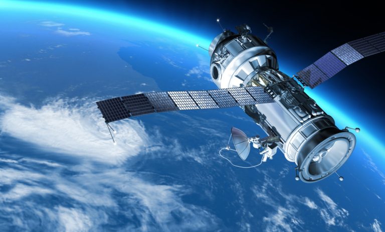
Satellites play a critical role in disaster management, providing essential communication and data services when terrestrial infrastructure is damaged or overloaded. They serve as a lifeline from space, enabling emergency first responders to implement and coordinate disaster relief plans, maintain contact with affected areas, and ensure timely aid and recovery efforts.
During disasters, when traditional communication networks are compromised, satellites step in to fill the gap. They support voice, data, and video communications, providing vital connectivity for emergency responders and affected communities. Satellites also play a crucial role in ensuring connectivity for residents impacted by disasters, allowing them to stay in touch with their loved ones and receive important news and recovery updates.
Having satellite communication capabilities during disasters is of utmost importance. It enables emergency responders to coordinate efforts, communicate effectively, and make informed decisions. Satellites serve as reliable and immediate communication links, bridging the gap when terrestrial infrastructure is compromised.
Moreover, satellites contribute significantly to disaster assessment and response by providing high-resolution imagery and mapping. This aids in assessing damage, identifying priority areas for response, and monitoring recovery processes. Satellite technology also plays a crucial role in disaster prevention and mitigation, with advanced sensors and monitoring systems providing essential data for predicting and mitigating the impact of disasters.
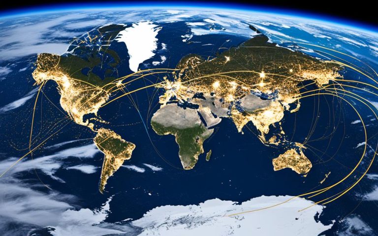
International collaboration in the space industry further enhances disaster relief efforts. Space agencies and private companies work together to share satellite data and resources, facilitating more effective and efficient disaster response.
Satellites in disaster management are indeed a lifeline from space, revolutionizing the way we prepare for, respond to, and recover from natural disasters. Their integral role in communication, mapping, assessment, prevention, and international collaboration makes them indispensable tools in ensuring the safety, resilience, and well-being of communities affected by disasters.
The Importance of Satellites in Disaster Communication
Satellites play a vital role in ensuring effective communication during disasters, especially when terrestrial infrastructure is compromised. These powerful space-based technologies provide reliable and immediate communication links that enable emergency responders and relief workers to coordinate their efforts and maintain contact with affected areas.
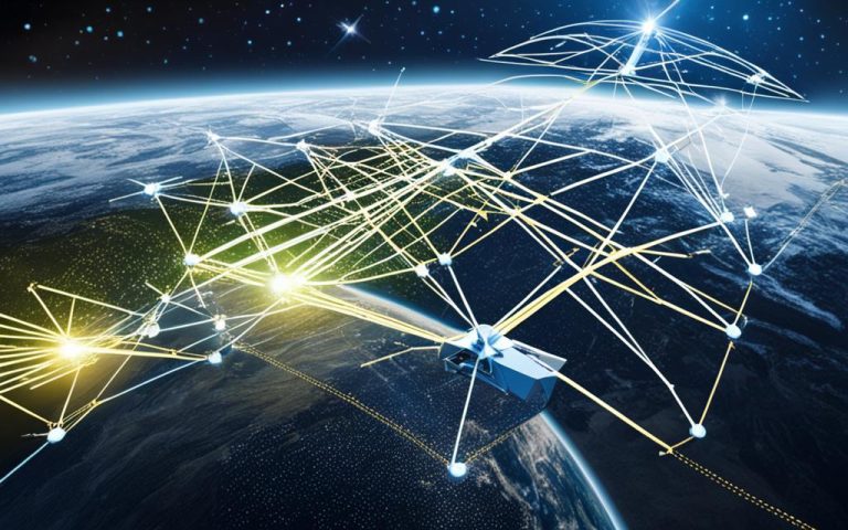
Satellites support various forms of communication, including voice, data, and video, establishing crucial networks and facilitating the flow of information between different response teams. This seamless communication enables prompt decision-making and enhances the efficiency of disaster response operations.
Furthermore, satellites enable airports to continue operating their control towers, access GPS systems for navigation, and monitor real-time weather conditions. This uninterrupted connectivity is essential for ensuring the safe landing and departure of relief flights, as well as for monitoring weather patterns to make informed decisions in real-time.
Satellite communication is not limited to airports; it is also vital for other essential facilities and services during disasters. Shelter locations, emergency response and healthcare centers, and utility operations heavily rely on satellite connectivity to ensure efficient coordination and the rapid dissemination of critical information. Additionally, satellite communication provides backhaul for cell phone networks, allowing uninterrupted communication services even in areas where terrestrial networks have been affected.
Satellites are the backbone of disaster communication, connecting response teams, critical infrastructure, and communities in times of crisis.
Benefits of Satellite Communication in Disaster Response:
Reliable and immediate communication links
Facilitates coordination between emergency responders
Enables real-time monitoring of weather conditions
Supports navigation for relief flights
Crucial for shelter locations, emergency response, and healthcare centers
Provides backhaul for cell phone communication during emergencies
The Role of Satellite Communication in Disaster Communication:
Facility/Service
Importance of Satellite Communication
Airports
Enables control tower operations, navigation, and weather monitoring
Shelter Locations
Ensures efficient coordination and dissemination of critical information
Emergency Response and Healthcare Centers
Facilitates seamless communication and coordination for better response
Utility Operations
Supports efficient coordination and maintenance of essential services
Cell Phone Communication
Provides backhaul for uninterrupted connectivity during emergencies
Overall, satellite communication acts as a lifeline during disasters, ensuring that critical communication channels remain operational. The swift and reliable transmission of information via satellite technology enhances the effectiveness of disaster response efforts, ultimately saving lives and minimizing damage.
Satellite Imagery and Mapping in Disaster Assessment
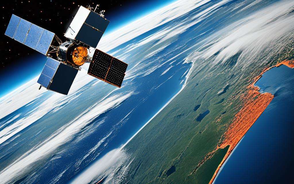
Satellite imagery plays a vital role in disaster management by providing valuable insights for assessing damage, identifying priority areas for response, and monitoring recovery processes. The high-resolution satellite images enable emergency managers to understand the extent of the damage, create accurate maps of the disaster zones, and navigate unfamiliar terrain effectively.
By overlaying satellite maps with data on population density, infrastructure, and transportation networks, vulnerable communities can receive timely assistance, ensuring that aid reaches those who need it the most.
Satellite-based monitoring systems also play a crucial role in disaster assessment. These systems detect ground movement, which provides early warning of potential landslides and volcanic eruptions. Such early detection helps emergency response teams take proactive measures to safeguard lives and property.
Advantages of Satellite Imagery in Disaster Assessment:
Accurate damage assessment: Satellite imagery provides high-resolution images that aid in accurately assessing the extent of damage caused by a disaster.
Identification of priority areas: Satellite mapping enables emergency managers to identify priority areas that require immediate response and assistance.
Efficient resource allocation: By analyzing satellite images, authorities can allocate resources effectively, ensuring maximum impact and faster recovery.
Monitoring of recovery processes: Continuous satellite monitoring allows for the tracking of recovery processes, assisting in evaluating the effectiveness of ongoing efforts.
By harnessing the power of satellite imagery and mapping, disaster management teams can make informed decisions, enhance response strategies, and ensure the most efficient allocation of resources in times of crisis.
Overall, satellite imagery and mapping are essential tools in disaster assessment, aiding in accurate damage assessment, priority identification, resource allocation, and ongoing monitoring of recovery efforts.
Benefits of Satellite Imagery and Mapping
Advantages
Accurate damage assessment
High-resolution images enable accurate assessment of the extent of damage.
Priority area identification
Satellite mapping helps identify priority areas that require immediate response and assistance.
Efficient resource allocation
Analyzing satellite images allows for the effective allocation of resources.
Monitoring recovery processes
Continuous satellite monitoring helps track the progress of recovery efforts.
Satellite Technology for Disaster Prevention and Mitigation
Satellites play a crucial role in preventing and mitigating the impact of disasters. Equipped with advanced sensors, earth observation satellites enable continuous monitoring of environmental conditions, providing crucial data for faster and more accurate predictions. This satellite technology proves invaluable in enhancing preparedness for extreme weather events, allowing meteorologists to track and analyze weather patterns effectively.
One of the key benefits of satellite-based monitoring systems is their ability to detect human activities that contribute to increased flood risk. By identifying areas prone to flooding, timely interventions can be implemented, and better land management strategies can be formulated to mitigate potential disasters.
Satellite technology also plays a significant role in preventing food shortages and famines. Through remote sensing and crop failure detection, satellites provide essential data for monitoring crop health and identifying regions at risk of food insecurity. This data enables proactive interventions, ensuring food production and distribution systems are optimized to prevent shortages and support sustainable agricultural practices.
Overall, satellites contribute significantly to disaster prevention and mitigation efforts. Through their data collection and monitoring capabilities, they provide valuable insights and enable proactive measures to reduce the impact of disasters on vulnerable communities.
Benefits of Satellite Technology for Disaster Prevention and Mitigation:
Continuous monitoring of environmental conditions for faster and more accurate predictions.
Enhanced preparedness for extreme weather events.
Detection and monitoring of human activities contributing to increased flood risk.
Implementation of timely interventions and better land management strategies.
Remote sensing and crop failure detection to prevent food shortages and famines.
Proactive measures to support sustainable agriculture and optimize food production and distribution.
Benefits
Description
Continuous monitoring
Provides fast and accurate data for predictions
Enhanced preparedness
Enables proactive measures for extreme weather events
Flood risk detection
Identifies areas prone to flooding and enables timely interventions
Land management strategies
Supports better land use planning and management
Food security
Ensures early detection of crop failures and supports agricultural planning
Sustainable agriculture
Optimizes food production and distribution systems
Key Takeaways:
Satellite technology plays a vital role in disaster prevention and mitigation. It enables continuous monitoring of environmental conditions, enhances preparedness for extreme weather events, and detects human activities contributing to increased flood risk. Additionally, satellite-based remote sensing and crop failure detection support efforts to prevent food shortages and promote sustainable agriculture. Through their data collection and monitoring capabilities, satellites provide essential insights for proactive disaster management.
International Collaboration in Disaster Relief
The space industry plays a crucial role in fostering international collaboration and cooperation in disaster relief and emergency recovery. By sharing satellite data and resources, space agencies and private companies significantly enhance global efforts to respond to natural disasters. Initiatives such as the International Charter on Space and Major Disasters provide a valuable framework for utilizing space-based resources during times of crisis.
This international collaboration ensures the most effective and efficient use of satellite assets for disaster relief efforts. By pooling resources and expertise, countries can leverage the power of satellite technology to mitigate the impact of disasters and support effective emergency response. The sharing of satellite data and communication resources enables a more comprehensive and coordinated approach to disaster management.
“International collaboration in satellite-based communication and data sharing enhances emergency response capabilities and promotes better disaster management practices worldwide.”
Through international cooperation, satellite-based communication systems can be optimized to support disaster relief operations, improving connectivity and facilitating real-time information sharing. This enables emergency responders, relief organizations, and local authorities to make informed decisions and effectively allocate resources.
Moreover, international collaboration in disaster relief promotes the exchange of best practices and lessons learned. By sharing experiences and knowledge, countries can improve their preparedness and response strategies, learning from past disasters and continuously enhancing their disaster management capabilities.
International collaboration in disaster relief is an essential component of building a resilient global community. By harnessing the power of satellite technology and working together across borders, countries can better respond to disasters, provide timely aid, and ultimately save lives.
Key Benefits of International Collaboration in Disaster Relief:
Enhanced global response to natural disasters
Efficient utilization of satellite assets for disaster relief efforts
Improved connectivity and communication during emergencies
Promotion of better disaster management practices worldwide
Exchange of best practices and lessons learned
Benefits of International Collaboration in Disaster Relief
Description
Enhanced global response to natural disasters
Coordinated efforts and combined resources enable a more effective and timely response to natural disasters on a global scale.
Efficient utilization of satellite assets
Sharing satellite data and resources ensures the most efficient use of satellite assets for disaster relief efforts, optimizing their impact and reach.
Improved connectivity and communication
International collaboration in satellite-based communication systems enhances connectivity and facilitates real-time information sharing during emergencies.
Promotion of better disaster management practices
By exchanging best practices and lessons learned, countries can continuously improve their disaster management strategies and enhance preparedness.
Exchange of knowledge and experiences
International collaboration fosters the exchange of knowledge and experiences, allowing countries to learn from each other and develop more effective disaster response strategies.
International collaboration in disaster relief is vital for creating a safer and more resilient world. By leveraging the power of satellite technology and working together, countries can strengthen their disaster management capabilities and save lives in times of crisis.
Conclusion
Satellites have revolutionized disaster management, serving as a lifeline from space by providing crucial communication and data services during times of crisis. These technological marvels enable emergency responders to implement proactive relief plans, maintain contact with affected areas, and coordinate recovery efforts. In situations where terrestrial infrastructure is compromised, satellites become essential in facilitating communication by supporting vital services such as airports, shelter locations, healthcare centers, and utility operations.
One of the key contributions of disaster management satellites is their ability to provide backhaul for cell phone communication, ensuring uninterrupted connectivity for affected communities. This connectivity plays a vital role in enabling residents to stay in touch with their loved ones, seek necessary assistance, and receive important news and recovery updates.
In addition to their communication capabilities, satellites also play a pivotal role in disaster assessment, prevention, and mitigation. By providing high-resolution imagery and mapping, they assist in accurate damage assessment, identification of priority areas for response, and monitoring of recovery processes. Satellite technology, such as remote sensing and monitoring systems, aids in early detection of potential disasters like landslides and volcanic eruptions, allowing for timely interventions and planning of effective recovery efforts.
Furthermore, international collaboration within the space industry enhances disaster relief efforts by fostering the sharing of satellite data and resources. Initiatives like the International Charter on Space and Major Disasters provide a framework for global cooperation in utilizing space-based resources during times of crisis. This collaboration ensures the most effective and efficient use of satellite assets, leading to improved disaster response capabilities and better disaster management practices worldwide.
In summary, disaster management satellites serve as an invaluable lifeline from space, revolutionizing the way we respond to and recover from disasters. Their role in communication, assessment, prevention, and international collaboration makes them indispensable tools in building resilient communities and mitigating the impact of disasters.
FAQ
How do satellites play a role in disaster management?
Satellites play a crucial role in disaster management by providing essential communication and data services when terrestrial infrastructure is damaged or overloaded. They enable emergency first responders to implement and coordinate disaster relief plans, maintain contact with affected areas, and ensure timely aid and recovery efforts.
What types of communication do satellites support during disasters?
Satellites support voice, data, and video communications during disasters. They establish crucial networks and facilitate the flow of information between different response teams. Satellites also provide backhaul for cell phone communication in remote areas, ensuring connectivity for residents impacted by disasters.
How do satellites contribute to disaster assessment and recovery?
Satellites play a vital role in assessing damage, identifying priority areas for response, and monitoring recovery processes. High-resolution satellite imagery helps emergency managers understand the extent of damage, create accurate maps of disaster zones, and navigate unfamiliar terrain. Satellites also contribute to effective disaster assessment and aid in planning recovery efforts by providing data for accurate damage assessment and proactive interventions.
How do satellites help prevent and mitigate the impact of disasters?
Satellites equipped with advanced sensors monitor environmental conditions and provide crucial data for faster and more accurate predictions. By continuously monitoring weather patterns, satellites help meteorologists track extreme weather events and enhance preparedness. Satellites also contribute to disaster prevention and mitigation efforts through their data collection and monitoring capabilities, including detecting human activities contributing to increased flood risk and preventing food shortages and famines.
How does international collaboration play a role in disaster relief?
The space industry fosters international cooperation and collaboration in disaster relief and emergency recovery. Space agencies and private companies share satellite data and resources, significantly improving natural disaster response. Initiatives like the International Charter on Space and Major Disasters provide a framework for global collaboration in utilizing space-based resources during times of crisis, enhancing emergency response capabilities and promoting better disaster management practices worldwide.
In today’s interconnected world, maritime connectivity plays a crucial role in facilitating seamless communication and ensuring the safety and efficiency of sea communication. Satellite networks have emerged as a vital…
Machine-to-machine (M2M) communication is a vital aspect of connecting devices without human intervention in satellite networks. These networks rely on robust protocols to ensure seamless and efficient M2M communication. In…
GPS technology has become an indispensable part of our daily lives, revolutionizing the way we navigate and interact with the world around us. From smartphones to vehicle navigation systems, GPS…
Artificial intelligence (AI) has emerged as a game-changer in the field of satellite networks. It offers the potential to optimize network operations and extract valuable insights for analysis. By employing…
Satellite internet access has become a powerful tool in bridging the digital divide and connecting remote areas that previously lacked reliable connectivity. This technological breakthrough has revolutionized the lives of…
When it comes to military operations, satellite technology provides invaluable advantages and defense capabilities. Military satellites have become indispensable assets in ongoing conflicts, offering a plethora of strategic benefits to…


 over Satellite: Bridging Terrestrial and Space Networks")
 Technologies: Elevating Data Rates")